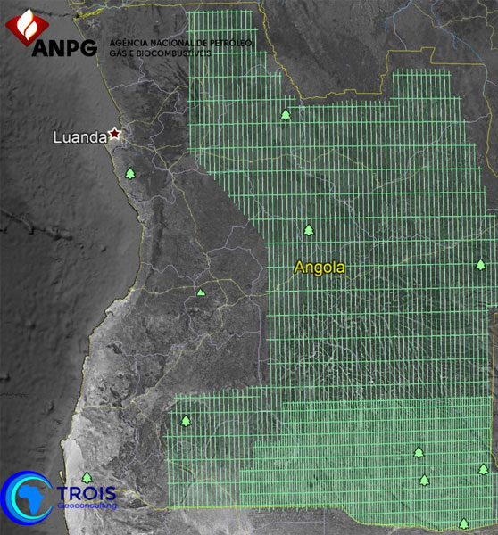
Interior Basins Gravity Data
- Datasets consists of 100,000 line kms of Gravity and Magnetic data.
- Line Spacing is 12 Km with 6 Km in-fills in the Okavango and Ovambo Basins.
- Survey acquired in 2003 using GT1-A Gravity Meter.
- This is the only gravity data set covering the interior basins of Angola.
Angola Aeromagnetic Compilation
- More than 500,000 line km of data acquired from 2007 to 2012.
- Complete coverage at 1 km spacing of Offshore and 2 km transition zone areas including:
- Kwanza Onshore and Offshore
- Lower Congo
- Benguela Basin
- Namibe Basin
- Congo and Kwanza Ultra Deep
- Continuous data set from on-shore to deep water and COB
